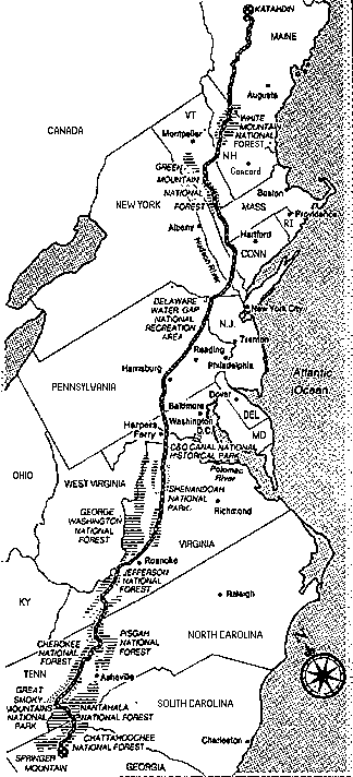
|
Main Page
|
What's New?
|
State by State
|
More Info
|
A.T. Clubs
|
Guestbook
|
|
Journals
|
FAQ
|
Advice
|
.GIF Maps
|
Mailing List
|
Books, Maps, etc.
|
Online A.T. Maps
Here is a
16 k. map
of the A.T.
Here is the
same map as above
but with clickable links to the various states along the A.T.
The
newest version of the NPS's A.T. map
is now available.
This page has the NPS
map of the AT
broken up into 5 pieces. (From the Fox's page where
the whole map
appears.)
This trails.com page
has links to info about all the trail by state
and most have accompanying topo maps when you look at an individual section of the trail.
The AT in Georgia
Map with trail descriptions from the
NBATC Website.
(Tye River area south to Black Horse Gap)
A map of the A.T. from the P.A.T.H. page
(Mount Rogers area)
A map of the
Nantahala area
in North Carolina. A much
larger map
of the same area. (These on the the
Nantahala Hiking Club Page.
)
PATC maps page
shows all the maps that PATC has available for sale.
Some NPS maps of Shenandoah Park are also available online thanks to Andy Hiltz of PATC.
The Northern Section
- 253 K.
The Central Section
- 314 K.
The Southern Section
- 296 K.
Overall Map of Maryland Parks
- Choose Western Maryland and then click on links to parks that AT goes through (14,15,16 and 17) to get more info and maps of those parks.
Map of trails in Pennsylvania - including route of the A.T.
- from KTA website.
AT in Delaware Water Gap area
- from Tom Caggiano's NJ page.
A Map of the A.T. near Manitoga in N.Y.
Map of Sterling Forest in New York
from the AMC-New York/North Jersey Page.
Map of AT in NY-NJ area
from the NY-North Jersey AMC Website.
Overview Map of Area Covered by NY-NJ Trail Conference
- showing the route of the Long Path, and the Highlands Trail as well as the A.T.
The AT in Connecticut
The Long Trail in Vermont
- Topo Maps
AT in the Franconia Notch Region in the Whites in N.H.
from the White Mountains Info Server.
Here is the map collection at the U. of Texas.
It includes many maps of National Parks, including SNP and the Smokies, as well as the C and O Canal.
Try Out Map Blast
for a map of a specific location that you're interested in.
USGS Topo Maps available on CD-ROM
or try
Maptech
if the other link does not work.
TopoZone
- Topo maps online!!
|
Back to Main Page
|